Gita in bici / Bike Ride in the Gers, Hautes-Pyrénées and Tarn-et-Garonne
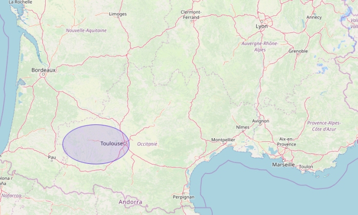
- Il sud-ovest della Francia con la zona della gita indicata in blu / Southwest France with our ride area picked out in blue
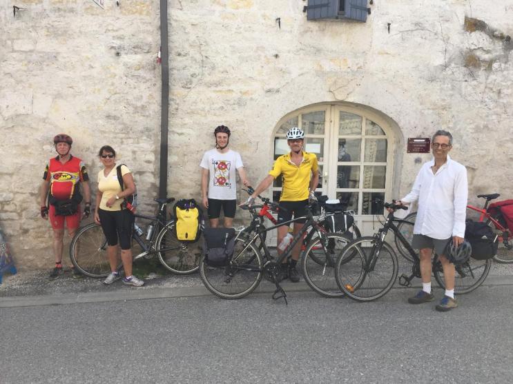
With Anthony, Richard and James Dawton, Dee Loader and Mike Ivy.
Our annual summer bike ride took us round Gascony in south-southwestern France, home to French rugby, solid country cooking and fine wine. The region is also crossed by the pilgrim route to Santiago de Compostela, the “Camino”. We started from Toulouse and ended up in Montauban, taking in, among many other places, the little church of Notre Dame des Cyclistes, on the northwestern edge of our region. Weather mainly good, accommodation mixed but generally good. Terrain: no serious climbs but undulating farmland and river valleys. These can sometimes be as tiring as Alpine climbs! But now let’s go there…
La nostra gita annuale in bici ci ha portati in Gasconia, nel sud-est della Francia. In questa regione il rugby francese è a casa. Al turista offre, inoltre, la tipica cucina regionale e ottimi vini. Ed è attraversata dal famigerato Camino di Santiago de Compostela. Siamo partiti da Tolosa ed abbiamo finito a Montauban. Abbiamo visitato tra molti altri posti, la famosa chiesa di “Notre Dame des Cyclistes”, nell’angolo nordovest della nostra regione. Le condizioni meteorologiche sono state abbastanza buone, l’alloggio un po’ misto ma generalmente buono. Come terreno: saliscendi tipici delle campagne del sud-ovest della Francia con tanto di valli con fiumi. Non molto difficile insomma ma tali terreni possono a volte essere faticosi quanto la montagna. E ora, andiamoci …

Day 1: Fri 17 August 2018
Toulouse – Auch – Mirande.
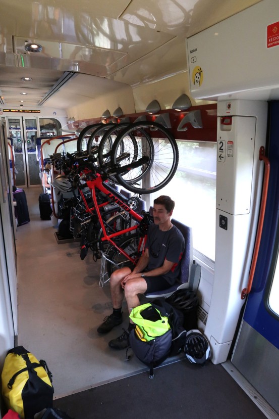
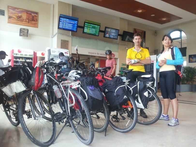
- Meeting 11:00 am at Toulouse, at the “Recycles” Giant bike shop and rental, 228 avenue du Muret.
- Lunch in central Toulouse.
- Train from Toulouse-Matabiau to Auch on a TER (Train Express Régional) train. Cost 10 euros each; TER trains don’t charge extra for bikes. About an hour’s train ride.
- Auch (Gers) to Mirande by bike. The route:
- D943 to Barran and L’Isle de Noé. Barran has an impressive gateway but otherwise nothing. L’Isle de Noé had a welcoming artisan bakery where we had some cakes.
- D137 from L’Isle de Noé to Mirande. This is a small white road located just to the west of route D939 and running parallel to it along the Baissol River.
- This white road was officially closed owing to a serious landslide where it runs thru a wooded area. We clambered over the mudslide with some difficulty. Like an idiot, I failed to take photos of this.
Ride stats: Distance 33 km; average speed 15 km/h; time 2h 6’ 26”
Mirande: medieval town with a church propped up by a flying buttress. We slept at the 3-star Hotel Prince. Semi-luxury rooms; the public areas carried posters of local theatre productions signed by the actors.
Dinner was at the Grand Café Glacier on the town square. Quite good tucker when it came but the service was erratic. I had a delicious “confit de canard”, fruit salad and a glass of Armagnac.
Prima giornata: venerdi 17 agosto 2018: Toulouse – Auch – Mirande.
- Incontro alle 11 in Toulouse al negozio “Recycles”, specializzato in bici “Giant”, anche da noleggio, indirizzo 222 avenue du Muret. Un negozio simpatico ed accogliente.
- Abbiamo pranzato in modo semplice nel centro di Toulouse.
- Treno da Toulouse-Matabiau ad Auch con un treno TER ovvero Train Express Régional. Costo €10 a testa, le bici hanno viaggiato gratis. Durata percorso un’ora.
Auch-Mirande in bici. Il percorso:
-
- Strada D943 per Barran e L’Isle de Noé. Barran ha una porta d;ingresso impressionante che da accesso al centro storico ma altrimenti ci sta poco per trattenere il visitatore. A L’Isle de Noé c’era un panificio-pasticceria artigianale dove abbiamo mangiato delle buone torte.
- Dopo L’Isle de Noé: strada D137 verso Mirande lung oil fiume Baissol. La strada era ufficiosamente chiusa per una frana ma l’abbiamo presa lo stesso. Abbiamo superato la frana senza grosse difficoltà.
Mirande: piccolo centro medioevale con una chiesa imponente. Sulla piazza principale c’erano delle belle case parzialmente in legno. Abbiamo cenato al Grand Café Glacier: cibo buono (“Confit de canard”) ma il servizio era un po’ capriccioso.

Abbiamo dormito all’albergo Hotel Prince, semi-lusso. Nei spazi pubblici c’erano dei poster che favevano la pubblicità per le produzioni teatrali della zono, con le firme degli attori. Carino.
Statistica persorso: Distanza km 33; velocità media 15 km/h; tempo impiegato 2 ore 6’ 26”
Day 2: Sat 18 August 2018
Mirande – Bassoues – Plaisance – Nogaro. The route:
- Mirande – Montclar-sur-l’Osse – St Christaud – Bassoues along D159.
- Copious lunch at Bassoues.
- Bassoues is a good example of a ‘bastide’ or fortified hilltop town with an impressive castle at the eastern end. The other prominent feature is the covered market area with elaborate wooden supports. The main road runs through the centre of this. The northern side of the market square is taken up with two restaurants making Bassoues a very popular stop. The village has various antique and art shops.
- From Bassoues to Courties along D943 then towards Lasserade along a white road, but beforehand, a sharp left to Plaisance to cross route D3, which last is not a road to cycle along if avoidable.
- Drinks at Plaisance before moving north towards Nogaro.
- Plaisance to Coudérot, uphill and into a forest, then Pouydraguin, Gellenave, along the Petit Midour river to Sorbets and thence into Nogaro.
- Hotel: “Le Commerce” a short distance from the old town. It was closed as the owners were away at a wedding, but the neighbour and her cat opened it up for us.
- Dinner: in the town centre, recommended by the hotel’s neighbour, but it was a mediocre experience.
Accommodation Info: James Dawton writes:
RESTAURANT LE COMMERCE NOGARO: 2, place des Cordeliers, 32110 Nogaro Tel +33 (0)5 62 09 00 95.
Mail: hotelrestaurant-lecommerce@orange.fr
265.00 euros for accommodation/breakfast for the five of us, 18/19th August.
This is the one where the lady next door let us in. I thought I’d left my shorts there, but they say they don’t have any, just bought a replacement pair.
They took cards for payment.
Ride stats: Distance 69.7 km; average km/h 15; time: 4h 26’ 15”; max km/h 45.
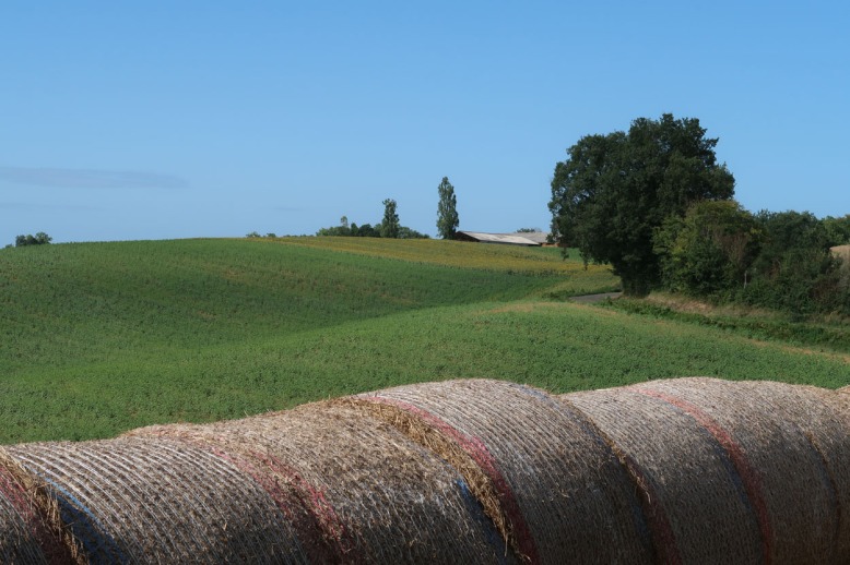
Other features of the ride: after Bassoues, fields with gaggles of geese awaiting fattening for foie gras. See photo below:

Giorno 2: sabato 18 agosto. La strada: Mirande – Bassoues – Plaisance – Nogaro. Dettagli:
- Mirande – Montclar-sur-l’Osse – St Christaud – Bassoues lungo la strada provinciale D159.
- Pranzo abbondante a Bassoues sul lato nord della piazza mercato, coperta da una bella struttura in legno.
- Bassoues è un buon esempio di una ‘bastide’ ovvero cittadina fortificata, diffusa in questa regione della Francia. Un castello dall’aspetto potente domina il lato est del paese. La strada principale taglia il paese, incluso il mercato, in due. Il paese è abbastanza turistico con vari negozi di antiquariato e d’arte.
- Da Bassoues a Courties lungo la D943, poi verso Lasserade lungo una strada bianca. Prima, abbiamo girato a sinistra verso Plaisance, attraversando la strada provincial D3, la quale, trafficata, è meglio evitare.
- Sosta rinfresco a Plaisance prima di avviarci in direzione nord verso Nogaro
- Da Plaisance a Coudérot, lungo una salita e attraverso una foresta, poi Pouygraduin e Gellenaye, lungo la torrente Petit Midoux verso Sorbets e quindi Nogaro.
Alloggio Albergo-Ristorante “Le Commerce”, 2 place des Cordeliers. 32110-Nogaro. Tel +33 5 62 09 00 95. Sito: hotelrestaurant-lecommerce@orange.fr. Euro 265 per la note, per cinque persone. Si puo pagare con una carta.
Cena ristorante in paese consigliato dalla direzione dell’albero; l’abbiamo trovato piuttosto mediocre.
Statistica percorso: distanza 69.7 km, velocità media 15 km/h; velocità massima 45 km/h; tempo 4 ore 26’ 15”.
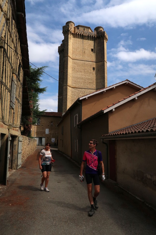
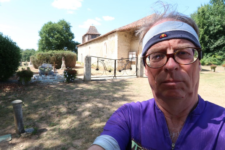
Day 3, Sun 19 August 2018: Nogaro – Estang – Labastide d’Armagnac – Notre Dame des Cyclistes – Cazaubon – Gabarret – Escalans – Labarrère – Montréal

- Two high points of the day: the exquisite town square of Labastide d’Armagnac, and the small church of Notre Dame des Cyclistes which I had long wanted to see.
- Lunch was at Labastide, a hearty meal. But can anyone remember what we ate?
- Labastide is remarkably picturesque with a beautiful central square. See photo below:

- Between N.D. des Cyclistes and Gabarret we followed an abandoned railway that had recently been converted to a bike and riding track. But the going was tiring on the loose gravel which often made up the surface.

- At Montréal we slept at the “Refuge Napoléon”, a hostel for pilgrims on the Santiago de Compostela route run by a Portuguese lady from Bragança. She also had a farm and a shop selling her produce. All five of us slept in a dormitory and had a night that was as comfortable as any of the hotels.
- Dinner was at a local pizzeria with just once guy serving at table, so e had to wait. Nice food when it came, however.

Accommodation Info: James Dawton writes:
Gabriel Zago (stamp on receipt):
Cassagnaous, 32250 Montreal – Du – Gers. Tel 05 62 29 44 81
120.50 euros for accommodation (103.00 euros for 5 of us in the room) plus extra for sheets/towels/breakfast
Hostel/dormitory run by Maria. She took cash only.
Ride stats: I failed to note stats for today’s trip but a study of the IGN map suggests we did about 70 km.
Giorno 3: Domenica 19 agosto 2018
Nogaro – Estang – Labastide d’Armagnac – Notre Dame des Cyclistes – Cazaubon – Gabarret – Escalans – Labarrère – Montréal
- Due punti alti della giornata: la piazza squisita Place Royale del paese di Labastide d’Armagnac; essa serviva una volta da arena per la “corrida” ovvero combattimento con I tori; e la piccolo chiesa di Notre Dame des Cyclistes, che da tempo volevo vedere.
- Abbiamo pranzato, e molto bene, a Labastide, ma chi si ricorda cosa abbiamo mangiato? Sicuramente qualche “charcuterie” (affettati) della zona, forse anche canard (anatra) e un buon vino rosso.

- Notre Dame des Cyclistes non dista molto da Labastide. Tra Notre Dame e Gabarret abbiamo seguito, in parte, una ferrovia dismessa, ormai una pista per ciclisti ed cavallerizzi. Ma il suo rivestimento sconesso rende il ciclismo faticoso.
- Arrivati a Montréal du Gers, abbiamo trovato il “Refuge Napoléon, un’alloggio per i Pellegrini destinati per Santiago di Compostela, gestito da una signora portoghesa originaria di Braganza. Aveva anche una fattoria e un negozio dove vendeva i suoi prodotti. Abbiamo dormito, tutti e cinque, in un dormitorio che era comodo quanto qualsiasi albergo.
- Abbiamo cenato ad una pizzeria in paese, che avevo soltanto un cameriere; pero’ I pasti, quando sono arrivati, erano gustosi.

Informazioni alloggio (appunti di James Dawton)
Gabriel Zago (timbro sulla rcevuta),
Cassagnaous, 32250 Montreal – du – Gers. Tel 05 62 29 44 81
Si accettano solo contanti.
Statistica del percorso: Non l’ho notato! Pero un’analisi della mappa IGN indica una distanza di circa 70 km.
Back to top / Torna in cima della pagina
Day 4: Mon 20 August 2018
Montréal – Condom – Lectoure – Miradoux – Flamarens – Valence s/Agen

Montréal to Fourcès along D29, then Fourcès to Condom along D114
- Stopped in Condom by the Cathedral for a second breakfast, ice creams etc. Outside the Cathedral was a striking metal sculpture of four musketeers. Condom is a fine market town, well worth a stop. Note: there is no evidence of any connection between this city and the well-known safe sex device. Condom is also known as Condom-en-Armagnac and the immediate area is known as the Condomois.

- Condom to Lectoure along white roads skirting south of the main D7 via Terreaube.
- Lectoure, on the river Gers, appears as a small city of turrets standing on a hill. Lunch stop in a restaurant with a garden.

- Lecoture to Miradoux along D23, then D71 northeast to Sistels, Dunes and Donzac, then D12 towards Auvillar, but then a hard left along D953 over the Garonne river and its Lateral Canal and into Valence-sur-Agen.
- The barista at the central bar found us a place to stay in a nearby “Chambres d’Hotes”. The only hotel there is almost perpetually full, occupied by workers at the nearby nuclear power station. Monsieur Joel, a retired clothes manufacturer, turned out to be a charming and assiduous host, providing a copious breakfast, including bacon, the following morning. He even had a small swimming pool in his yard.
- Dinner was less satisfactory. We were victims of the provincial French Monday syndrome. The only open restaurant, not crowded, told us we would have to wait an hour to be served. Serious understaffing or serious incompetence? In the end we had a perfectly wholesome dinner at a cheerful Moroccan place (excellent merguez, or spicy beef sausages and popular in north Africa and the south of France) not far from the central square.
Once again, I failed to collect stats for this stage but I estimate we covered about 70 km.
Giorno 4: lunedi 20 agosto 2018

Montréal – Condom – Lectoure – Miradoux – Flamarens – Valence s/Agen
- Montréal-Fourcès per la provinciale D29, inseguito Fourcès-Condom per la D114.
- Una sosta alla città pittoresca di Condom, un paese essenzialmente agricolo ma anche abbastanza turistico. Davanti alla Cattedrale c’è una bella sculture di quattro moschettieri. Nota bene che non c’è nessuna connessione confermata tra il nome della città ed il famigerato profilattico. Condom si chiama anche Condom-en-Armagnac e la zona si chiama il Condomois.
- Da Condom a Lectoure per delle strade bianche sulla mappa, pero asfaltate e poco trafficate. Si passa al sud della trafficata D7 via Terreaube.

- Da Lectoure a Miradoux per la D23 poi la D71 in direzione nordest verso Sistels, Dunes e Donzac.
Poi la D12 verso Auvillar, poi una svolta a sinistra lungo la D953 attraverso il fiume Garonne e i canali laterali, nominati Canal du Golfech e Canale Laterale de la Garonne. La Garonne è il fiume principale del sudovest del Paese, che sbocca in Atlantico vicino a Bordeaux.

- Siamo arrivati a Valence-sur-Agen, paese principale della zona. Piu’ giu’ per il fiume si nota il centrale nucleare e sperimentale di Golfech.
- Il barista del bar centrale ci ha trovati dei posti per dormire ad un vicino “Chambres d’hotes” ovvero alloggio per turisti in una casa private. L’unico albergo del paese, nominato ironicamente “Le Tout Va Bien”, è quasi sempre pieno di gente che lavora alla centrale. Monsieur Joel, produttore di moda in pensione, era un padrone di casa simpatico e ospitale. La prima colazione era abbondante e includeva uova, bacon e altri ingredienti per una perfetta colazione all’inglese. Aveva anche una piccola piscina nel suo giardino.
- La cena era meno soddisfacente. Siamo state vittime della sindroma del lunedi francese, per la quale molti locali erano chiusi. All’unico ristorante aperto, sulla piazza principale, ci hanno detto che c’era un’ora da aspettare, pero’ non era affollato. Mancanza di personale oppure incomptetenza? Non abbiamo capito, ma eventualmente abbiamo mangiato decentemente in un locale marocchino, La Medina, con tanto di merguez ovvero salsiccie di agnello molto diffuse nel meridione della Francia. Non serviva bevande alcoliche.
Ancora una volta ho omesso di notare tempi, distanze e velocità ma stimo un percorso di circa 70 chilometri.
Back to top / Torna in cima della pagina
Day 5: Tue 21 August 2018
Valence s/Agen – Bourg de Visa – Montaigu de Quercy – Tournon d’Agenais – Fumel
- D11, D128, D127, D16 to Bourg de Visa. Lunch there by the main road.
- To Montaigu de Quercy on route D7, then D18 to Tournon d’Agenais, then D102 to Fumel which stands high above the Lot river.
- Fumel turned out to be a dull place despite its impressive setting dominating the Lot river: no real centre and just one overpriced hotel, the Brit Hotel near the cathedral. We were told later that many industries, such as the Fumel foundry, and other businesses had closed with the result than many people had moved away, explaining the relative lifelessness of the city.
- Dinner, rather chic, just near the tourist office.
Accommodation Info: Mike Ivy writes:
Brit Hotel Fumel: Place Léo Lagrange – 47500 FUMEL. Tel 05 53 40 93 03. info@brit-hotel-fumel.fr
1 x Chambre à 1 personne € 69; 2 x chambres à 2 personnes € 144; taxes de séjour € 3.50; 5 x petit déj € 45; total à payer € 261.50 (à cinq personnes)
Brit Hotels are a chain with 130 establishments throughout France.
Ride stats: Distance 64.4 km; average km/h 15; time 4h 7’ 10”; max km/h 45.
Giorno 5, martedi 21 agosto 2018: Valence s/Agen – Bourg de Visa – Montaigu de Quercy – Tournon d’Agenais – Fumel

- D11, D128, D127, D16 da Valence a Bourg de Visa. Pranzo a Bourg sulla strada principale all’ingresso del paese. Buono ma non ho i dettagli!
- A Montaigu-de-Quercy per la D7, poi la D18 a Tournon d’Agenais, poi la D102 per Fumel, paese arrocato sul fiume Lot
- Fumel si è rivelato un paese noioso, anche un po’ triste malgrado il suo ambiente impressionante. Non c’è un vero centro con caffè o bar; c’era soltanto un’albergo un po’ troppo costoso, anche se c’era una piccolo piscina. Ci hanno detto dopo che molte industrie, ad esempio la fonderia, hanno chiuso i battenti e di conseguenza molta gente è andata via.
- Cena, abbastanza elegante, in un ristorante vicino all’ufficio di turismo.
Accommodation Info: Mike Ivy writes:
Brit Hotel Fumel: Place Léo Lagrange – 47500 FUMEL. Tel 05 53 40 93 03. info@brit-hotel-fumel.fr
1 x Chambre à 1 personne € 69; 2 x chambres à 2 personnes € 144; taxes de séjour € 3.50; 5 x petit déj € 45; total à payer € 261.50
Brit Hotels are a chain with 130 establishments throughout France.
Ride stats: Distance 64.4 km; average km/h 15; time 4h 7’ 10”; max km/h 45.
Day 6: Wed 22 August 2018
Fumel – Touzac – Puy l’Eveque – Preyssac – Luzech – Cahors.
- From Fumel, we crossed the Lot river towards Montayral.
- Here, an abortive attempt to find a riverside path to take us east along the Lot. This involved going down, and then back up, a steep track into the river valley. A shame because a riverside route here would have been fun.
- Returning to the plain above the river valley, we continued along routes D4 and D5 to Mauroux, Lacapelle-Cabanac and Puy l’Eveque. (Did we have lunch at Puy l’Eveque?)
- Route D811 east to Preyssac, then over the Lot river to Anlars-Juillac, Albas and Luzech
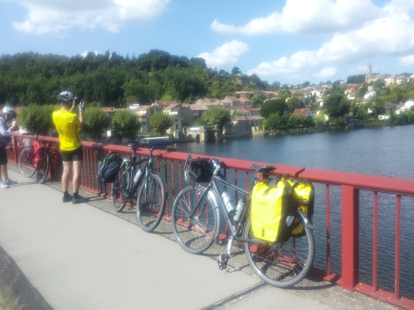
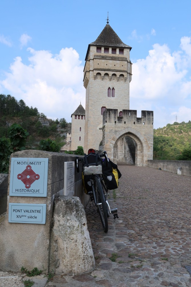
- Then east along route D8 to Douelle and then Cahors. I-spy the famous, spectacular 14th century bridge, Pont Valentré, spanning the Lot river.
- In Cahors, the tourist office found us rooms at the hotel Coin des Halles in the old town: a cheerful place with a bar.
- Dinner was less lucky: we inadvertently chose a rather pretentious place with prices to match but food quality that did not match. Rule: go for the unpretentious if possible. Not always easy: Cahors is very touristy.
Ride stats: Distance 65.3 km; av. km/h 15; Time 4h 18’ 44”; Max km/h 51.
Fumel – Touzac – Puy l’Eveque – Preyssac – Luzech – Cahors.
La statistica del giorno: distanza 65.3 km, velocità media 15 km/h, tempo 4 ore 18’ 44”. Max km/h 51..
- Da Fumel abbiamo attraverso il fiume Lot verso Mont ayral..
- Qui abbiamo provato,senza riuscire, di trovare un sentiero lungofiume che ci portasse verso est. Siamo dovuto scendere una ripidissima strada verso il fiume – per poi risalire causa impossibilità di trovare un lungofiume! Peccato, perché sarebbe stato davvero simpatico proseguire lungo il fiume.
- Siamo quindi tornati alla pianure, con le sue coltivazioni di mais e girasole, per poi proseguire lungo le stradine D4 e D6 verso Mauroux, Lacapella-Cabanac e Puy l’Eveque. Ma abbiamo pranzato a Puy L’Eveque? Non mi lo ricordo.
- Strada D811 direzione est verso Preyssac, poi abbiamo attraversato il fiume Lot verso Anlars-Juillac, Albas e Luzech.
- Pii sempre in direzione est lungo la strada D8 verso Douelle e poi Cahors, capoluogo del département del Lot. Da notare: il palcoscenico Pont Valentré che attraversa il fiume.
- L’ufficio del turismo a Cahors ci ha trovato delle stanze all’albergo Coin des Halles in pieno centro storico, un posto simpatico ed allegre con un bar animato.
- Per cenare siamo stati meno fortunati: abbiamo scelto un ristoranto un po’ pretenzioso con tanto di prezzi che non corrispondevano con la qualità. La regola: puntare sui posti semplici, impresa non sempre facile a Cahors, che è abbastanza touristique quoi.
Day 7: Thursday 23 August 2018
Cahors – South along Route N20 then D659 to L’Hospitalet – D659 to Castelnau-Montratier – D4 then D68 to Vazerac – D109 then D20 to Lafrançaise (Tarn-et-Garonne).

Ride stats: Distance 53.6 km; average km/h 15; time 3h 25’ 28” – Max km/h 39.
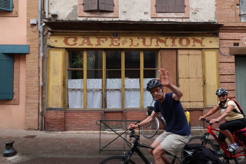
- Our first stop at L’Hospitalet lived up to its name by providing a wayside bar-cum-grocery: “Orangina”, coffee and victuals for the ride. Très sympa. See pic at the top of this page.
- Lunch at Castelnau-Monratier. This was considerable success in this small town with an arcaded square typical of Gascony. An added bonus was the presence of a dream car: a 1961 Citroen DS “décapotable” whose Belgian owner puts 20,000 km on it every year. Such cars are worth €250,000 in concourse condition.

- I had fish (forget what it was!) for the first time. Well cooked.
- Arrived at Lafrançaise at five p.m. No hotel in this small town: there had been one but it was closed. The tourist office directed us to a “gite à la ferme”, oddly named “Les Trouilles” (The Frights) about 2 km back up the road we had come along.
- “Les Trouilles” turned out to be a marvellous, peaceful place with a swimming pool! We slept in two adjacent rooms with a bathroom.
- Dinner was simple but superb, with “cassoulet de canard”, local wine and a local prune liqueur or rocket fuel, as someone in our group termed it.
- It was obviously a big, even prosperous, farm, to judge by the impressive John Deere combine harvester and tractors parked in a shed.
- Les lecteurs (The Readers) all’agriturismo “Les Trouilles”
Accommodation Info: James Dawton writes:
Ferme – Auberge Sarl Des Trouilles,
82130 La Francaise.
Tel 05 63 65 84 46
Total cost 199 euros, as follows;
96 euros for accommodation (2 big rooms)
100 euros for 5 evening meals.
3 euros for “digestif” (your glass of lighter fuel).
They took cash only, no cards.
Da Cahors verso sud lungo la strada nazionale N20 poi la provinciale D659 al paesino di L’Hospitalet. Si continua lungo la D 659 a Castelnau-Montratier, poi la D4 e la D68 per Vazerac. Inseguito, la D20 per Lafranaise (Tarn-et-Garonne)
Statistica del percorso: distanza 53,6 km; velocità media 15 km/h; tempo 3 ore 25’ 28”; velocità massima 39 km/h
- La nostra prima sosta a L’Hospitalet, conformemente al nome del paesino, ci fu molto accogliente in quanto aveva un bar simpatico che ci ha fornito caffè, “croissants” e viveri per la gita. Molto simpatico.
- Pranzo a Castelnau-Montratier. Un grande successo: ci siamo trovati in un paese tipico del sud della Francia, con una piazza ad arcate, giardini e banchetti. E di più: c’era una bellissima automobile d’epoca, la classica Citroen DS “spider”, con la quale il proprietario belga percorre oltre 20.000 km ogni anno. Tali automobili possono costare €250.000 se sono in condizioni da concorso.
- Ho mangiato pesce, molto ben preparato – ma ho dimenticato quale pesce è stato!
- Siamo arrivati a Lafrancaise alle 5 del pomeriggio. Niente alberghi in questo posto piccolo: ce n’era stato uno ma era chiuso da tempo. L’ufficio del turismo ci ha indicato un’agriturismo fuori paese, col nome strano “Les Trouilles” (Le Paure) ad una distanza di 2 km lungo la strada che avevamo appena fatto.
- “Les Trouilles” si è rivelato un posto stupendo, con una piscina! Ci hanno dato due camere adiacenti con un bagno condiviso.
- La cena è stata semplice ma di ottima qualità: “cassoulet de canard” ovvero una stufata di anatra, vino locale e un digestivo fatto di liquore di prugne ovvero “carburante da razza”, come diceva un membro del nostro gruppo.
- Evidente era una fattoria molto redditosa, a giudicarne dalla presenza di enormi trattori “John Deere” parcheggiati sotto le capanne.
Informazioni alloggio, ricordo di James Dawton:
Ferme – Auberge Sarl Des Trouilles,
82130 Lafrançaise.
Tel 05 63 65 84 46
Costo totale 199 euro, quanto segue:
96 euros per pernottamento (2 big rooms)
100 euros per la cena a 5
3 euros per il digestivo.
Si accettono solo contanti, niente carte.
Day 8: Friday 24 August 2018
Lafrançaise – D45 then D42 then minor road D72 along the west bank of the Tarn river to Montauban via Albefeuille-Lagarde.
Ride stats: Distance 25.1 km; average km/h 17; Time 1h 25’ 31”; Max km/h 32
- Trafficky main roads to begin with, not helped by the first rains of the trip and the fact that Anthony and I went the wrong way out of Lafrançaise to begin with, heading to Moissac instead of Montauban. We quickly corrected this.
- Route D72 was much pleasanter and we stopped for a second breakfast at Albefeuille-Lagarde, enabling us to escape for a few minutes from the crachin or constant drizzle.
- Rolled into Montauban just after lunchtime. Lunch was snacks bought at the station where we got tickets for Toulouse and onwards, in my case, to Avignon via Narbonne. For me, the ticket including bike cost €57.
- Avignon: arrived at 20h30, too late to conduct a proper search for budget accommodation. The nearest “Formule 1” was at Courtines, 2km away near the TGV station. So I put up at the Ibis Budget for €75 for a room. They gave me five per cent off for being a previous customer.
- Dinner, or really a schnak, in the old city.
- Attractive light and image display on the façade of a church nearby.
Giorno 8: venerdi 24 agosto 2018
Lafrançaise – la provinciale D45 poi la D42 poi strada minore D72 lungo la riva occidentale del fiume Tarn fino a Montauban via Albefeuille-Lagarde.
Statistica del percorso: distanza 25,1 km, velocità media 17 km/h; tempo 1 ora 25’ 31”; velocità massimale 32 km/h
- La strada principale era trafficata all’inizio e le prime piogge della gita non certo hanno aiutato la situazione. Da aggiungere il fatti che io ed Anthony siamo partiti in direzione sbagliata, andando verso Moissac anziché verso Montauban, un’errore che abbiamo corretto senza perdere troppo tempo.
- La strada D72 è stata molto più gradevole e ci siamo fermati per una seconda prima colazione ad Albefeuille-Lagarde, il che ci ha permesso di scappare dal “crachin” ovvero pioggina costante per alcuni minuti.
- Abbiamo raggiunto Montauban poco dopo l’ora di pranzo. Il pranzo ha consistito di pannini comprati alla stazione dove abbiamo coprato i biglietti per Tolosa nel caso dei miei compagni di viaggio, Anthony, Richard, James e Dee. Io invece ho continuato fino ad Avignone via Narbonne. Il costo totale del mio biglietto era €57.
- Avignon: ci sono arrivato alle 20:30, troppo tardi per cercare un pernottamento economico. Il “Formule 1” più vicino si trovava a Courtines, vicino alla stazione TGV, fuori città. Invece mi sono ripiegato sul’Ibis Budget ed una camera a € 78. Mi hanno dato uno sconto di 5% perché ero già stato cliente.
- Ho cenato in maniera leggera nel centro storico, dove sono capitato su uno spettacolo di luci ed immagini proiettate sulle pareti di una chiesa.
Day 9: Saturday 25 August 2018
Avignon – Cavaillon – Cheval-Blanc – Lauris – Cucuron
Ride stats: distance 70.3 km; average km/h 16; time 4h 10’ 52”; max km/h 16
- Tedious ride out of Avignon to Cavaillon along route D970. A lot of semis and trailer trucks as well as cars. This part of the trip is 27 km and took me an hour and fifteen minutes according to my notes, which seem optimistic.
- Cavaillon is an attractive small town of ancient Roman origins, with an old Jewish quarter.

- Had lunch at a boulangerie artisanale where the girl in charge came from the Souf region of eastern Algeria, on the edge of the Sahara.
- Stopped at Mérindol for a beer, and again at Lauris for some sightseeing.
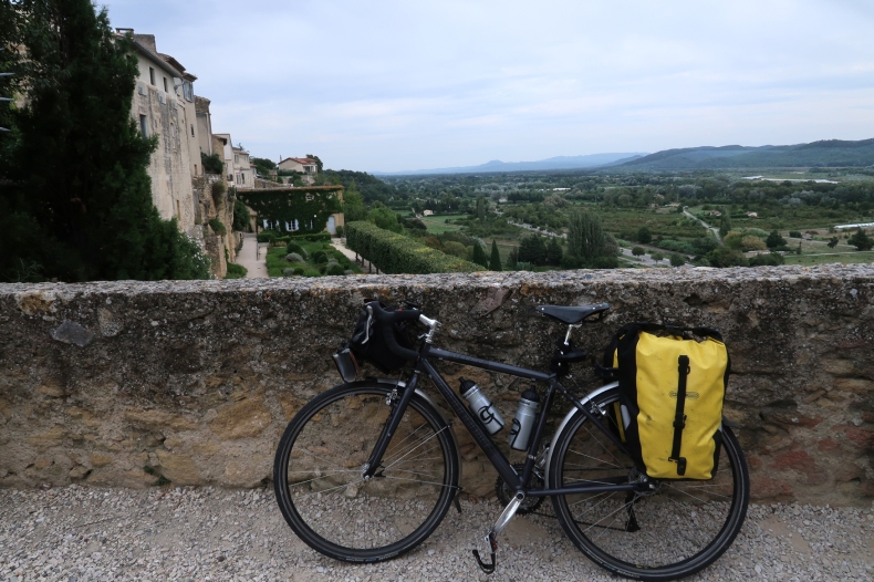
- Rolled into Cucuron at around 18h30 in time for a pastis with Distinguished Cyclist Julian Thmas.
Giorno 9, sabato 25 agosto 2018
Avignon – Cavaillon – Cheval-Blanc – Lauris – Cucuron
Statistica del percorso:distanza 73,3 km; velocità media 16 km/h; tempo impiegato 4 ore 10’ 52”; velocità massimale 39 km/h
- L’uscita da Avignone è noiosa, lungo la trafficatissima strada provinciale D970. E’ piena di semirimorchi e autotreni, oltre alle automobili. Questa sezione del percorso mi ha impiegato un’ora e 16 minuti, per uan distanza di 27 km, a secondo i miei appunti.
- Cavaillon è una cittadina attraente con antiche origini romane e ospita un antico quartiere ebreo con tanto di sinagoga e museo.
- Ho pranzato ad un boulangerie artisanale ovvero panificio artigianale presidiato da una ragazza algerina che è della regione dello Souf nel nord Sahara.
- Da Cavaillon ho fatto la D973, una strada relativamente comoda, con saliscendi non troppo impegnativi.
- Una sosta a Méridndol per una birra, poi a Lauris per qualche minuto di turismo. Da Lauris si ottiene una bella veduta sulla vallata del fiume Durance.

- Sono arrivato a Cucuron verso le 18:30, all’ora dello “pastis” a casa del Grande Ciclista Julian Thomas (vedi foto galleria)
Maps and navigation:
- Our main map was IGN sheet R16 (Midi-Pyrénées) on a scale of 1: 250 000. We found this map detailed enough for our trip – it even marked “Notre Dame des Cyclistes”. However, a more updated version might have shown the “voies vertes” or disused railway tracks converted into bike routes.
- The IGN 1:100 000 are excellent: highly detailed with gradients and contours. However over a long ride you may find yourself with an abundance of maps.
- For the Vaucluse I used Michelin regional sheet #527 Provence-Alpes-Cote d’Azur on a scale of 1:275 000. This was quite adequate for my very normal route.
- There is always the GPS navigator on your smartphone. If there is no signal – often happens – you’ll be without Google Maps. Consider downloading Osmand Maps from Google Play or Apple. These will work offline. You have to pay after six downloads. They’re organised by country and region.
Mappe e navigazione
- La nostra mappa principale è stata il foglio IGN (Institut Géographique Nationale) no. R16 Midi-Pyrénées alla scala di 1:250 000. Era adeguatamente dettagliata per la nostra gita – indica anche la piccola chiesa di “Notre Dame des Cyclistes” – ma una versione più aggiornata indicherebbe, senza dubbio, le “voies vertes” ovvero vie verdi, ferrovie dismesse convertite in piste ciclabili.
- Le mappe IGN al 1:100 000 sono dettagliatissime, con indicazioni sulle salite e quote altrimetriche. Però per una lunga gita occorrerebbe portare diversi fogli che occupano spazio.
- Per percorre il Vaucluse ho usato la mappa Michelin foglio no. 527 Provence-Alpes-Cote d’Azur
- C’è sempre il navigatore del proprio smartphone. Però può capitare un ‘assenza di campo. Si consiglia di scaricare “Osmand Maps” da Google Play o Apple. Esse funzionano senza Internet e si ne può scaricare fino a sei gratis. Vengono organizzate per Paese e regione, perfettamente adeguata per il mio percorso piuttosto di routine”.
